I swear this isn’t a deliberate ploy to attract Sarah Hoyt’s attention … although her links from Instapundit are always a welcome boost to daily readership. This is a post from Merryn Walters’ Mapping History Substack trying to determine the origins and intent of a map created for Portuguese use in WW2:
Maps are a weapon – a powerful weapon – because maps look, simply, like facts. A map says, “this is how things are”, and a mapmaker can change the world … so it’s no surprise, mapping had its run as a propaganda tool during the Second World War.
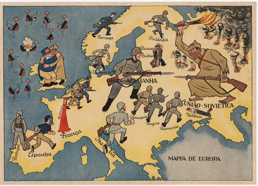
Our main map in this article, for example, begs the question: is it a propaganda map of Portugal or a Portuguese propaganda map? The two are very different, and between 1939 and 1945 the difference mattered. A Portuguese propaganda map was one made by Portugal, for Portuguese purposes. A propaganda map of Portugal – or, more often, one dressed up in Portuguese – was made by someone else entirely, and slipped under Lisbon’s door. Portugal was neutral, you see, which made it one of the few places left in Europe where both sides could still advertise their intentions: British and German propagandists worked the same streets targeting the same people, each assuring the Portuguese that the other lot were dastardly fellows.
A map was ideal for this. There’s a snag though, in this propaganda metier, and it’s worth keeping at the back of our minds as we admire the pretty pictures; no matter how good the mapmaking, the actual map can only inform and persuade a person who’s able to read it.
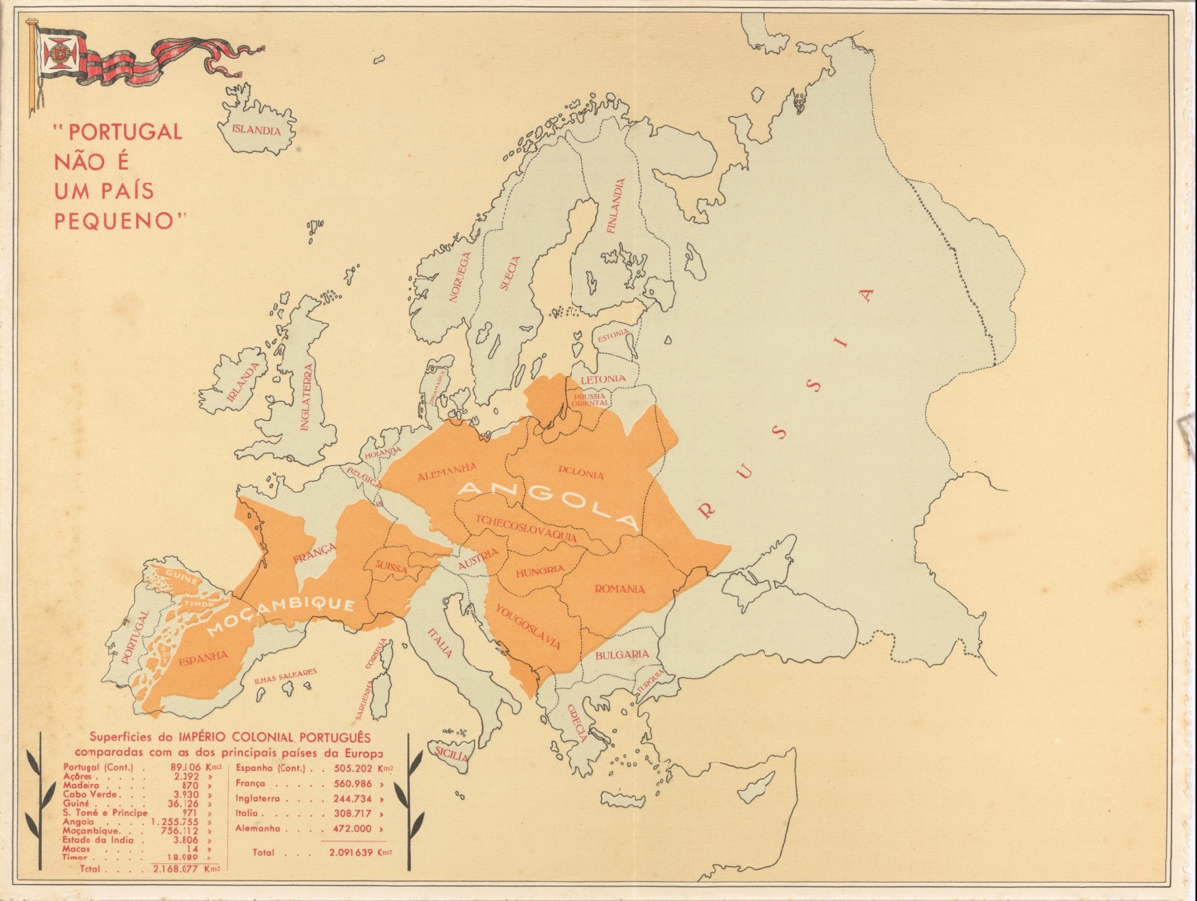
THIS IS NOT A SMALL COUNTRY
Portugal não é um país pequeno
Let’s start with the real thing. Portugal não é um país pequeno – “Portugal is not a small country” – was produced in 1934 by Henrique Galvão, an army officer and colonial administrator, for the First Portuguese Colonial Exhibition in Porto; an exhibition he also happened to be directing, which does rather simplify the commissioning process somewhat. The map was printed by Litografia Nacional, of Porto, and uses a simple trick that’s mirrored today by online whizzymajigs. thetruesize.com is one such.
Take Angola, Mozambique and the rest of the empire; colour them brightly; and lay them down, right across Europe, as if you’re floofing a blanket. Add a table of figures proving that Portugal and its colonies, together, outsize Spain, France, England, Italy and Germany combined. Small country? Certainly not, mon ami. Just badly folded.
This map worked so well, Salazar’s regime reprinted it for decades: postcards in Portuguese for home consumption; French and English versions for visitors; and — by 1951 — an edition from the Secretariado da Propaganda Nacional laid the whole lot over the United States instead – for the benefit of American tourists, who presumably needed a unit of measurement they could relate to. People ask where Brazil has gone. Independent since 1822, I’m afraid – a century too late to help with the arithmetic.
Galvão himself deserves more than a footnote. Post-war, in 1947, he reported on forced labour in those same colonies, concluding only the dead were truly exempt; he fell out with Salazar, was arrested in 1952, escaped – and in 1961 hijacked a liner, the Santa Maria, to make his point. Not many mapmakers manage a second act like that.