My conclusion was that the Rabbi’s view of the history of the ketubah fitted a pattern I have seen in other contexts — moderns believing in bogus history that supports their self image of superiority to those ignorant and unreasonable people in the past.
My favorite example is the Columbus myth, the idea that the people who argued against Columbus were ignorant flat-earthers who thought his ships would sail off the edge. That is almost the precise opposite of the truth. By the time Columbus set off, a spherical Earth had been the accepted scientific view for well over a thousand years. Columbus’s contemporaries not only knew that the Earth was round, they knew how big around it was, that having been correctly calculated by Eratosthenes in the third century B.C.
By the fifteenth century they also had a reasonably accurate estimate of the width of Asia. Subtracting the one number from the other they could calculate the distance from where Columbus was starting to where Columbus claimed to be going and correctly conclude that it was much farther than his ships could go before running out of food and water. The scientific ignorance was on the side of Columbus and those who believed him; he was claiming a much smaller circumference for the Earth and a much larger width of Asia, hence a much shorter distance from Spain to the far end of Asia. We will probably never know whether he believed his own numbers or was deliberately misrepresenting the geographical facts in order to get funding for his trip in the hope that he would find land somewhere between Spain and Japan, as in fact he did.
David D. Friedman, “Slandering the Past”, Ideas, 2018-02-14.
April 20, 2020
QotD: The Columbus myth
January 18, 2020
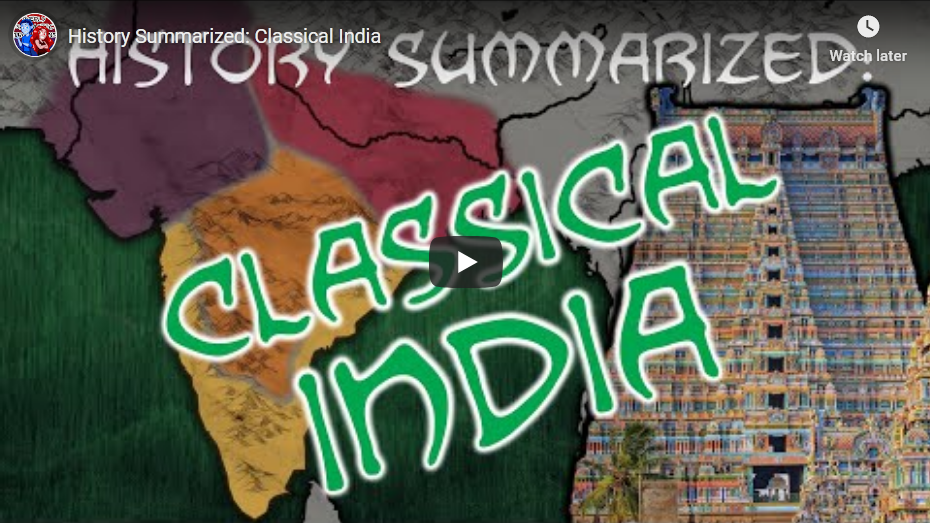
History Summarized: Classical India
Overly Sarcastic Productions
Published 17 Jan 2020Classical and Medieval Indian History is a tale of constant flux — but in between the dozens and hundreds of states at play across the peninsula, there are clear trends that arise. Let’s take this chapter of history as an opportunity to dig into different types of sources, and try and wrap our heads around a story that doesn’t fit neatly into a single chronology.
FURTHER SOURCES: The Discovery of India by Jawaharlal Nehru, “A History of India” by Michael H. Fisher (lecture courtesy of The Great Courses).
Our content is intended for teenage audiences and up.
PATREON: https://www.Patreon.com/OSP
DISCORD: https://discord.gg/y7uUnzJ
MERCH LINKS: https://www.redbubble.com/people/OSPY…
OUR WEBSITE: https://www.OverlySarcasticProductions.com
Find us on Twitter https://www.Twitter.com/OSPYouTube
Find us on Reddit https://www.Reddit.com/r/OSP/
December 22, 2019
The North Magnetic Pole … a refugee from Canada’s Arctic
Colby Cosh on the latest refugee to flee from Canada:
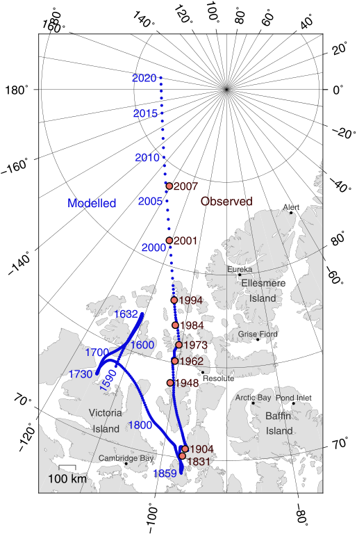
On Dec. 10, the World Magnetic Model used to calibrate compasses was officially updated. The “model” can be thought of as a map that you would use, given your location on or near the Earth’s surface, to find out how many degrees your magnetic compass is off from true geographic north (or south). This ordinarily happens every five years, but the wizards in charge of the system decided to update a year early because the north magnetic pole is moving particularly fast right now.
Positions of North Magnetic Pole of the Earth. Poles shown are dip poles, defined as positions where the direction of the magnetic field is vertical. Red circles mark magnetic north pole positions as determined by direct observation, blue circles mark positions modelled using the GUFM model (1590–1890) and the IGRF-12 model (1900–2020) in 1 year increments. For the years 1890–1900, a smooth interpolation between the two models was performed. The modelled locations after 2015 are projections.
Map by Cavit via Wikimedia Commons.As most Canadians will have heard, magnetic north is, at the moment, fleeing Canadian territory and heading toward Russia. The rate of change is still very high by historic standards, first established in the early 19th century, but it has slowed just a little. In the year 1900 the pole was firmly in the Canadian Arctic, off Somerset Island. It wandered north, broke out of our high Arctic archipelago in about 2000, and has been streaking Siberia-ward across the open sea at more than 50 km a year since. The time component in the new WMM forecasts a slight slowing over the next five-year period, to about 40 km/yr.
This, like everything else involving Earth’s magnetic field, is a bit of a guess. The WMM has to be updated often because it does incorporate guesswork about the magnitude and direction of changes in the short-term future. The model will be most accurate now, and increasingly less so over the five-year term as the magnetic poles do their little dance — independently, by the way; the magnetic poles are not exactly opposite the Earth from one another, and the “south” one is scooting along much more slowly than the “north.” (Also, the magnetic north pole, the one to which the “north” needle of your compass is attracted, is actually a “south” pole to physicists.)
The truth is that the naive inquirer should not research Earth’s magnetism in the expectation that it is as well understood by scientists as, say, oceanic tides. (You can probably detect that I am talking about myself here.) The question “Why is the magnetic pole leaving Canada?” does not really admit of a solid answer. Maybe it’s the investment climate?
Probably most everybody is dimly aware that the magnetic poles flip outright from time to time — every half-million years on average. But the assumptions embedded in your handheld compass run much deeper than that. The Earth itself is only a big dipole magnet generally, rather than locally, and there is no guarantee of only one “north magnetic pole” as the field is measured near the surface. Competing “north poles” can form. (Which would, at least, let Russia and Canada each have their own …)
November 29, 2019
England’s early search for new markets
In the latest installment of Anton Howes’ Age of Invention, he looks at the multiple crises that afflicted England in the mid-sixteenth century and some of the reactions to those setbacks:
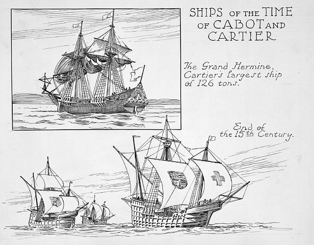
Ships from the period of John Cabot (Giovanni Caboto) and Jacques Cartier.
Illustration by Thomas Wesley McLean (1881-1951) via Wikimedia Commons.
From the 1540s through to the 1560s, [England] was beset by religious uproar, high inflation, hunger, rural and then urban unemployment, a fall-off in its major export trades, and widespread unrest. It was diplomatically isolated too. And I did not even mention the epidemics: the terrifying “sweating sickness” returned in 1551, deadly influenza swept the country in 1557, and in 1563 some 17,000 people in London were reportedly killed by the plague.
Yet, in the face of such problems, innovation in England began to pick up pace. The country, having once been a scientific and technological backwater, began to show signs of catching up. Why?
[…] The fall-off in trade with Europe, for example, seems to have had something to do with spurring the voyages of exploration in search of a north-west and north-east passage to the East Asia. Having lost Antwerp as a place to sell cloth in 1551, the English went in search of an arctic route to northern China and Japan. The expert geographers believed that those regions had a similar climate to that of Antwerp and the surrounding Netherlands, and so reasoned that the Japanese would therefore demand the same kinds of cloth. Although the English expeditions from 1553 onwards did not find a passage to Japan, they did establish trade routes with Russia via the White Sea, and they began to more actively consider the exploration and colonisation of North America. More importantly, with those voyages of exploration came greater experience of navigation, and it was not long before English ships were circumnavigating the globe (Francis Drake in 1577-80). Improvements to navigational techniques and instruments, as well as the ships themselves followed.
So it is tempting to think that necessity was initially the mother of invention, and that the many navigational and shipbuilding improvements of late-sixteenth-century England were its result. But I don’t think that this narrative quite works. I do not believe that necessity was the mother of invention.
For a start, voyages of navigation had already been attempted a number of times, long before the more successful ones in the early 1550s. The first explorers had reputedly gone west from Bristol in 1465, and certainly from 1480. And soon after the announcement of Columbus’s discoveries in the 1490s, the Venetian Zuan Chabotto (aka John Cabot), had sailed from Bristol with Henry VII’s blessing and claimed Newfoundland for both crown and Catholicism. Cabot had even hoped to found a penal colony on his second voyage in 1497, though for some reason the king did not provide the criminals. Throughout the early sixteenth century, the voyages continued. John Rastell, brother-in-law to Thomas More, the famous statesman and author of Utopia, in 1517 went in search of a north-west passage (though he never got beyond Ireland, because his crew decided it would be better to leave him there and sell the ship’s cargo in Bordeaux). Yet another voyage went west with Henry VIII’s support in 1527, but it mostly just found other Europeans — fishing fleets from Spain, Portugal, and France off the coast of Newfoundland (the English had made some catches there in the early 1500s, but apparently could not compete), and the Spanish everywhere else. The expedition made its way down to the Caribbean and then went home, with little to report. So people had already gone off exploring, long before the mid-sixteenth-century English commercial crisis. It suggests that there had already been both a latent supply and demand for such explorations.
December 27, 2017
India’s Geography Problem
Wendover Productions
Published on 5 Dec 2017
May 15, 2017
Geography and Economic Growth
Published on 9 Feb 2016
If you look at the African continent, perhaps the first word to come to mind is “enormous.” And that’s true. You could fit most of the United States, China, India, and a lot of Europe, into Africa. But if you compare Africa to Europe, Europe has two to three times the length of coastline that Africa has.
But what does coastline length have to do with anything?
Well, coasts mean access to water.
As benign as water might seem, it’s a major driver of economic growth. Adam Smith, the father of modern economics, argued that access to water reduced the cost of trade, and gave merchants access to larger markets. These larger markets incentivized specialization and innovation.
These twin processes ultimately spurred trade activity, and consequently, economic growth.
As an end result, civilization tended to grow wherever trade was easiest.
If you want proof of this, think of a few major cities.
Look at Istanbul, New York, Venice, Hong Kong, London, and similar areas. What do they all have in common? They all sit near a major coast or a major river. In contrast, look at some of the poorest areas in the world—places like Kampala, or Pointe-Noire. These places are all landlocked. Since goods are easier to transport over water than over land, trade in landlocked areas is more expensive.
And what happens when trade is more expensive?
It becomes harder to spark economic growth.
What this all means is economic growth is not only affected by a country’s rules and institutions, but by a country’s natural blessings, or natural hindrances, too. The effects of geography on growth cannot be discounted.
March 29, 2017
You can’t really understand history without considering the geography
At Samizdata, Brian Micklethwait discusses Tim Marshall’s book, Prisoners of Geography:
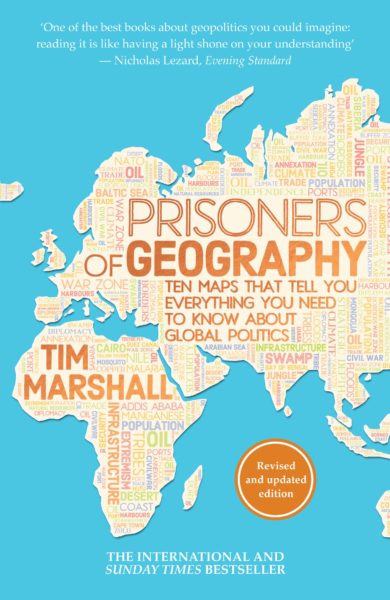
Britain and Western Europe, and then the other parts of the world where English is the dominant language, have mostly been blessed with a degree of geographically conferred freedom of manoeuvre that is denied to the inhabitants of pretty much all other nations. That is why these places got rich first. And it also now means that we Euros and Anglos are able to believe, as a matter of practical political policy rather than merely as privately pious aspiration, in a wide range of idealistic things of very variable value – things like freedom, democracy, equality, human rights, freedom for women, “social justice”. and so on and so forth – things that geographically more constrained people can only, as yet, dream of, and which they often regard as more as a threat to their own ways of doing things than as any kind of promise.
[…]
The word “maps” being in its subtitle, along with the bombastic claim that these maps tell you all you need to know about the world, these maps ought to be really, really well done, from the graphic point of view. But to my admittedly fading eye, they seemed to be not that good. On their own, they tell you nothing like everything about the world, which is why you actually need to read the book to get the points of all the maps. I was particularly disappointed by how the mountains look in these maps. Along with rivers, mountains are a big deal in this book, as you would expect them to be. But, in these maps, the mountains often scarcely register. It doesn’t help that the maps are done only with black ink on white paper. Colour would have helped. But even black ink could have been used, I feel, with somewhat greater clarity. I had to look quite hard to work out where these various mountains were. But, as I say, maybe that’s just me. My eyesight is definitely not what it was.
The mountainous insight I recall with particular pleasure is Marshall’s observation that the hostility between India and China would have been and would now be far greater, were it not for the most impenetrably formidable mountains on earth being at the boundary between these two civilisations. Contrast those impenetrable Asian mountains with that famous gap in the mountains in northern Europe, which results in a gigantic military parade ground with no natural barriers stretching from the Pyrenees to the Urals.
In addition to knowing better about Europe’s mountains, I now sort of know a whole lot more than I did about the mountains of South America. South America is, for me, one of the less fascinating places in the world, because, being so geographically cut off from the rest of the world and being of significance mostly only to their northern neighbours, South American mistakes count for a lot less than mistakes can elsewhere, especially mistakes made by the USA and Europe of course. South America, you might say, is basically just a big clutch of European mistakes.
Speaking of European mistakes, Marshall is very good on the habit of late nineteenth century Europeans of drawing straight lines upon maps of foreign parts, in defiance of geographical and consequent social and cultural and now “national” realities on the ground. The USA gets along fine despite all the straight lines that it contains dividing its states, because these states are, fundamentally, still very united, at least in the sense that everyone in them is quarrelling about the same things within the same political institutions. But the Middle East is still trying to shake free of its baleful legacy of fake states, which Europeans and now also Americans, all motivated by the need for oil, have expended so much of their own treasure and so much Middle Eastern blood trying to keep in being.
February 14, 2015
Europe in 1899, according to Fred W. Rose
Before the modern age of the infographic, artists like Fred W. Rose still had their own idiosyncratic ways to present as much information as they could for a wider audience:

H/T to Tam for the link.
August 24, 2013
The supercontinent of Pangaea with modern borders
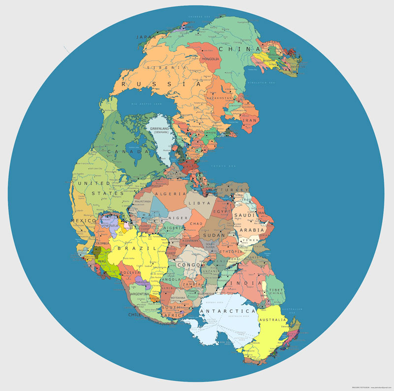
From TwistedSifter:
Pangaea was a supercontinent that existed during the late Paleozoic and early Mesozoic eras, forming about 300 million years ago. It began to break apart around 200 million years ago. The single global ocean which surrounded Pangaea is accordingly named Panthalassa.
April 14, 2010
July 15, 2009
Entertaining Timewaster
This should be a doddle for USians, but not so easy for those of us who always confuse those square-ish states in flyover country: Know Your States.
I managed 90%, but I dropped New Jersey accidentally, which certainly messed up my accuracy.
H/T to “JtMc” for the link.
(Cross-posted to the old blog, http://bolditalic.com/quotulatiousness_archive/005585.html.)