Ted Campbell on the need to upgrade NORAD radar installations as part of a general refurbishment of the alliance’s capabilities:

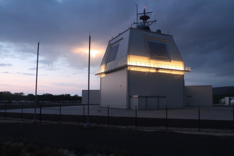
Lockheed Martin’s Solid State Radar has been designated as AN/SPY-7(V)1 by the US government.
Image from Lockheed Martin/PRNewsfoto.
One of the elements which might be considered in modernizing and enhancing the North American Aerospace Defence Command (NORAD) surveillance, warning and control system is a new radar and some people have suggested that the AN/SPY-7(V)1 radar, sometimes called Aegis Ashore, might be a useful (and proven, it is in use, on land, in Japan, and will be fitted on Canada’s new Type 26 (destroyer-frigate) combat ships) solution. This radar is eminently suitable to be part of an enhanced (conventional) NORAD and of a CANUS continental ballistic missile defence system.
There are many technical (and logistical) advantages to using that radar on both our, Canadian, warships and in a land-based role, too.
The AN/SPY-7(V)1 radar produces a lot more information than do the current AN/FPS-117 and AN/FPS-124 radars which are used in the NORAD role, today, and were built in the 1980s using 1960s and ’70s technology.
(Please don’t worry about the AN/*** designations. They are part of a very sensible American system which was designed to make it simpler to identify both Army and Navy systems (hence the AN/ at the beginning). The three letters following the AN/ describe the system:
- The first letter describes the installation. F means Fixed, on the ground (land) and S means on a ship;
- The second letter means the type of equipment, and P means radar; and
- The third letter means purpose. S means search (detection and locating) and Y surveillance and control.
Thus the SPY-7 is a shipborne surveillance radar and the FPS-117 is fixed (land-based) search radar. The numbers just differentiate one system from another.)
If Canada chooses an advanced radar, like the SPY-7, two engineering problems will need to be addressed:
- First, these things use a lot more power than do the existing radars; and
- Second, they produce much, much more information which needs to be “transported” instantly, to control centres in places like Canadian Forces Base North Bay, where all the data from all the radars is analyzed and used to effect NORAD’s mission. If the radar sites are located below (about) 72°N, as would be the case for coastal radars in BC, NS and NL, this is not a huge problem because the station is within the “footprint” of the big, high bandwidth satellites in geostationary orbit. But if the radar site is too far North then a terrestrial (possibly microwave, maybe tropospheric scatter) network (in which each station needs electrical power, too) will have to be installed to move the data to a satellite ground station. (Or a non-geostationary, high bandwidth, satellite system will have to be deployed.)


