
Thomas SowellTV
Published 17 Dec 2021
(more…)
August 28, 2023
Why Britain Advanced Before Other European Nations | Thomas Sowell
Comments Off on Why Britain Advanced Before Other European Nations | Thomas Sowell
August 16, 2023
Facts about Africa’s Geography never taught in schools | Thomas Sowell
Thomas SowellTV
Published 20 Nov 2021
(more…)
Comments Off on Facts about Africa’s Geography never taught in schools | Thomas Sowell
July 29, 2023
QotD: How pre-modern cities shaped the surrounding landscape
When it comes to shaping the landscape outside of the city – our main point of investigation – the key element of the pre-modern city that matters is the intense demand it creates for agricultural products that the non-farmers who live in the city cannot produce themselves, chiefly (but not exclusively!) food. The intensity of that demand scales with the size of the city. A small town might only really shape land-use and farming patterns out a few miles; a huge mega-city like first century Rome (c. 1m people) re-shapes land patterns for hundreds of miles, its economic influence intruding into the territory of other, smaller cities.
Every town or city, of course, will be different. For agricultural societies especially, local terrain sharply constrains possible land uses. Some land is simply too wet or dry or rough or rocky or infertile for this or that purpose. In a modern city, apartments or factories or offices can be built almost anywhere; the sort of land suitable for intensive farming is more limited. This is even more true for pre-modern societies working without modern fertilizer, without electric-powered irrigation and without the industrial technology to massively reshape terrain (draining swamps, filling ravines, flattening hills, irrigating the desert, etc – some of these can be done with hand tools, but not to the extent we can today).
Still, we want to begin thinking about how cities impact the land around them without all of these difficult and confusing variables. We want to image a city, isolated and alone in the middle of an endless, flat and featureless plain. This is exactly what J. H. von Thünen did in The Isolated State (Der isolierte Staat). This kind of exercise can give us a baseline of what the landscape around a decent sized city might look like, which we can then modify to respond to different terrain, technology and social organization.
(Note: I would be remiss if I didn’t note that my discussion of these ideas owes heavily to Neville Morley’s Metropolis and Hinterland (1996), where he applied this very method to the city of Rome and its hinterland (and also first introduced me to von Thünen’s ideas). That book and also his Trade in Classical Antiquity are both great books to give a read if you want to begin building a sense of how pre-modern economies work).
The key factor von Thünen looks at is transportation costs. For a society without trains or trucks, moving bulk materials of any kind over long distances is extraordinarily expensive. Moving grain overland, for instance, would cause its cost to double after 100 miles. Thus land close to our theoretical city is extremely valuable for production, while land far away is substantially less valuable (because the end goal is transporting the agricultural production of that land to the city). As a result, transit costs – and thus distance – dominates how cities influence land-use patterns (along with population, which determines the intensity of the city’s influence).
Bret Devereaux, “Collections: The Lonely City, Part I: The Ideal City”, A Collection of Unmitigated Pedantry, 2019-07-12.
Comments Off on QotD: How pre-modern cities shaped the surrounding landscape
July 24, 2023
Flattering our modern selves by throwing shade at our ancestors
David Friedman has encountered a lot of “just so stories” about the customs and practices of earlier cultures and points out that a lot of them are derived from ignorance and arrogance in roughly equal proportion:
My favorite example is the Columbus myth, the idea that the people who argued against Columbus were ignorant flat-earthers who thought his ships would sail off the edge. That is almost the precise opposite of the truth. By the time Columbus set off, a spherical Earth had been the accepted scientific view for well over a thousand years. Columbus’s contemporaries not only knew that the Earth was round, they knew how big around it was, that having been calculated by Eratosthenes in the third century B.C.
By the fifteenth century they also had a reasonably accurate estimate of the width of Asia. Subtracting the one number from the other they could calculate the distance from where Columbus was starting to where Columbus claimed to be going and correctly conclude that it was much farther than his ships could go before running out of food and water. The scientific ignorance was on the side of Columbus and those who believed him; he was claiming a much smaller circumference for the Earth and a much larger width of Asia, hence a much shorter distance from Spain to the far end of Asia. We will probably never know whether he believed his own numbers or was deliberately misrepresenting the geographical facts in order to get funding for his trip in the hope that he would find land somewhere between Spain and Japan, as in fact he did.1
Another example of the same pattern shows up in discussions of medieval cooking, one of my hobbies. Quite a lot of people believe that medieval cooks over spiced their food in order to hide the taste of spoiled meat. A few minutes of thought should be enough to see the consequences for a cook of routinely giving his employer and the employer’s guests food poisoning. Also that, with meat available on the hoof, there was no need to keep it until it spoiled and that it made little sense to save on meat, a local product, at the cost of spices that had to be transported over thousands of miles.
I like to ask people who claim the food was overspiced how they know, given that medieval European recipes almost never give quantities. One possible source for the belief — the overspicing, not the reason for it — is a passage in the introduction to Two Fifteenth Century Cookery Books, a collection published by the Early English Text Society.
Our forefathers, possibly from having stronger stomachs, fortified by outdoor life, evidently liked their dishes strongly seasoned and piquant, as the Cinnamon Soup on p. 59 shews. Pepper, Ginger, Cloves, Garlic, Cinnamon, Galingale, Vinegar, Verjuice, and Wine, appear constantly in dishes where we should little expect them; and even Ale was frequently used in Cookery.
“The cinnamon soup on p. 59” is not a recipe but an entry in a menu, so what the editor is complaining about is not the amount of cinnamon but the fact that it is there at all, and similarly for the rest of his list. That tells us more about English cooking of the 19th century than that of the 15th.
As far as I can tell, there is no evidence that medieval food was overspiced, only that they used spices in different ways than modern European cuisine. I have twice come across evidence on the question. There is a recipe for Hippocras, a spiced wine, in Le Menagier de Paris, a household manual dated to 1490. It is one of the rare recipes with quantities, sugar and spices by the ounce, wine by “quarts of Paris measure”. When I first made it I found the result too sweet and too highly spiced, so cut sugar and spice in half to fit my taste.
Many years later, when I mentioned the recipe in an online discussion, someone asked me whether I had checked the units. I had not, just assumed that a quart was a quart and an ounce an ounce. I was wrong — the period ounce was about an ounce but the quart by Paris measure was about twice our quart. In adjusting the recipe to my taste, I had gotten back to about the original proportions.
1. There is disputed evidence that he visited Iceland and might have heard about the existence of North America there, also speculation that he might have gotten the information from European fishermen. There were European ships harvesting Cod off what is now Newfoundland not long after Columbus, but earlier dates are speculative.
Comments Off on Flattering our modern selves by throwing shade at our ancestors
June 19, 2023
Why Rivers Move
Practical Engineering
Published 7 Mar 2023The basics of fluvial geomorphology (the science behind the shape of rivers)
Errata: At 11:54, the slope equation is inverted.
We’ve teamed up with @emriver, a company that makes physical river models called stream tables, to create a two-part series on the science and engineering behind why river channels shift and meander and what tools engineers use to manage the process.
(more…)
Comments Off on Why Rivers Move
May 22, 2022
QotD: Surveying Upper Canada
You have just drawn an Ontario Township.
Now, make your grid. The line roads, north and south, should be 100 chains apart (one-and-a-quarter miles), and the east-west sideroads either the same, or different. They needn’t come out evenly; you may leave a fraction on whichever side you didn’t start from. The whole board may have to be tilted at the “front” (baseline) to parallel a lakeshore, or accommodate the “back” of the next Township down. If you’re in the mood, you might want to draw a diagonal road, right through everything.
Congratulations. You may now have a job as one of His Majesty’s surveyors in pioneer Ontario. It’s a much better job than down south of British North America, where the land is somewhat populated already, and everyone seems to have an opinion. Up here, not yet any people in the way. But there is still the difficulty of slashing through the bush. You only draw “concessions” — future roads defining blocks, to be further subdivided into future farmlots. When the people granted land move in, they will be compelled by the guvmint to actually dig those endless, straight, access roads.
This will make the roads more interesting. Where the lines meet an obstacle, you get a little run around it. Or a big one, if the obstacle continues. Intersections don’t quite meet, so you get a jog. Or, you decide to put the jog in the middle of nowhere, instead. There were at least five major surveying systems in Upper Canada (later “Ontario”), and dozens of variations on each one. The line and side roads might be 66 chains apart, or more than twice that, depending on some local magnate’s whim. Or the surveyor may have been drunk that day.
David Warren, “Esquesan”, Essays in Idleness, 2019-04-10.
Comments Off on QotD: Surveying Upper Canada
April 1, 2022
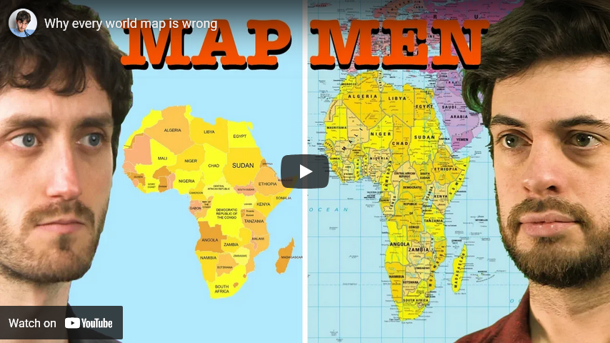
Why every world map is wrong
Jay Foreman
Published 20 Jun 2019Want to show this video to your geography class? A clean, school-friendly version of this video is here: https://youtu.be/J94N29NUtW4
BUY MUGS, T-SHIRTS, POSTERS ETC…
http://www.mapmenmerch.comSEE NEW EPISODES EARLY, AND BEHIND-THE-SCENES EXTRAS…
http://www.patreon.com/jayforemanHow do you show a round earth on a flat map? Is it possible? Jay and Mark find out using an orange and a rolling pin.
Written and presented by
JAY FOREMAN @jayforeman
MARK COOPER-JONES @markcooperjonesEdited by
JAY FOREMAN @jayforemanCamera
INDIA RAKUSEN @indiarakusenSee new episodes before anyone else, and get exclusive extras like out-takes and deleted scenes by signing up to my Patreon:
http://www.patreon.com/jayforeman
Comments Off on Why every world map is wrong
May 23, 2021
Peter Zeihan’s geographic-based perspective on world history
In another of the reader-contributed book reviews for Scott Alexander’s Astral Codex Ten, a look at The Accidental Superpower: The Next Generation of American Preeminence and the Coming Global Disorder by Peter Zeihan:
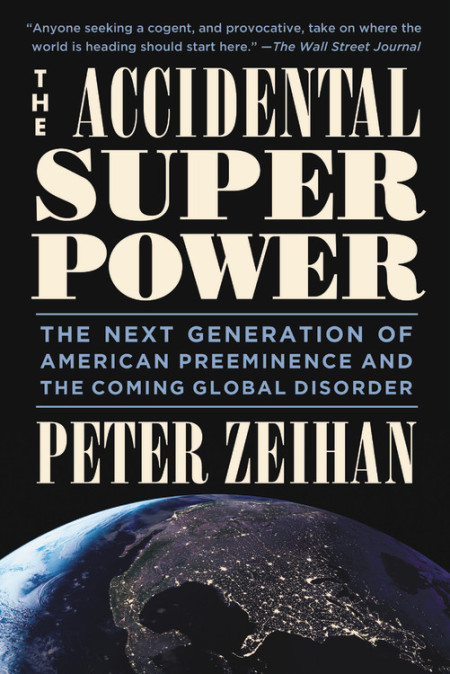
Zeihan’s primary models are influenced by his geographic-based perspective on how our world works. As he puts it in the introduction, “Geopolitics is the study of how place [rivers, mountains, etc.] impacts … everything.” Early chapters discuss what he calls the balance of transport, which is roughly easy transport within a country (for economic development and forming political and cultural ties) and hard transport from outside of it (for defense). These transport issues are inherently tied to geography. What’s the best way to move things? Water-based transportation is extremely cheap. Think 17 cents per container mile vs. $2.40 for semis on an American highway, with a more extreme disparity for other countries, trade between continents, and populations in hard-to-access places. On the defensive side of that equation, geographic features on borders such as deserts, mountains, and oceans get Zeihan’s attention.
He uses ancient Egypt to illustrate a great balance of transport. The reliable water and rich soil of the Nile’s floodplains created near-perfect farming conditions, and the Nile itself allowed easy travel and trade throughout the valley. Combined with impenetrable desert borders, this geography “was one of the few places in the world where there was enough water to survive, and enough security to thrive.” Because of that, the “geography nearly guaranteed that the Egyptians would be on the road to civilization.” He gives us a quick run through Egyptian history to tell a story of that road, beginning with the settlement of the area about eight thousand years ago, consolidation into a single kingdom more than five thousand years ago, and then stagnation as the increasingly centralized government devoted more labor to monument building rather than technological progress, eventually being conquered by seafaring people seeking to rule the Mediterranean.
*****
To escape our pre-civilization/hunter-gatherer days – Zeihan refers to this as “when life sucked” – the mechanism that he identifies is basically a typical economist’s story. Sedentary agriculture as invented by the Egyptians and other ancient cultures became a transformative technology, letting populations grow and devote labor and resources to non-farming purposes. From this, we got specialization, increased production, trade (particularly where there was easy transportation – population centers were always near water) and capital formation in a self-reinforcing cycle. For thousands of years after this transformative technology was introduced, incremental improvements in agriculture and other areas followed, but “a robust, secure, and sustainable food supply” was the base of any civilization.
This cycle accelerated when we harnessed a couple of new packages of technologies over the last six-hundred years. He lumps the source of much progress together with the terms deepwater navigation and industrialization. The first is everything needed to sail the seas, from shipbuilding capabilities to compasses to weapons. Industrialization is exactly what you’re thinking of. He simplifies it as the combination of labor and capital with higher-output energy sources like oil and coal to put productivity on steroids.
Zeihan gives us a story of the Ottoman Empire entering a prolonged decline as deepwater navigation technologies took off in the fourteenth century. These technologies enabled the European powers (first Portugal and Spain, and then England) to capture increasing shares of trade with Asia, dropping prices in Europe and depriving the Ottomans of much of the income to which they had grown accustomed. Most significantly, they turned “the ocean from a death sentence to a sort of giant river.” Trade became global, but it was still mostly among people with nearby water-based transportation.
Industrialization technologies changed that. Steam and coal brought power to mining and transportation, and along with interchangeable parts, improved manufacturing. Chemical breakthroughs led to fertilizers (improving crop yields), and with more transportation options, more land was brought into cultivation. Improvements in cements in the 1820s enabled larger buildings and infrastructure. These technologies continually improved the productivity cycle that began with agriculture.
Zeihan concludes a chapter on America with the “nuts and bolts” of how countries rule the world. “The balance of transport determines wealth and security. Deepwater navigation determines reach. Industrialization determines economic muscle tone. And the three combined shape everything from exposure to durability to economic cycles to outlook.” As we’ll see shortly, he really likes America’s position on all of these factors. But first, we need to understand the other analytical tool that informs Zeihan’s model.
Comments Off on Peter Zeihan’s geographic-based perspective on world history
March 22, 2021
The Geography of Spices and Herbs
Atlas Pro
Published 4 Jan 2019Fun fact, I got the idea for this video while working as a cook in a Taco Bar.
Support me on patreon maybe? https://www.patreon.com/atlaspro
“Arroz Con Pollo” Kevin MacLeod (incompetech.com)
Licensed under Creative Commons: By Attribution 3.0 License
http://creativecommons.org/licenses/b…

Comments Off on The Geography of Spices and Herbs
August 31, 2020
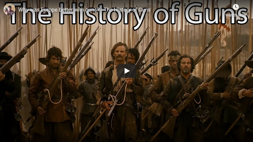
Why was Europe better with guns? – The History of Guns
History Clarified
Published 3 Dec 2018China invented gunpowder (combustible powder), so why was it the European nations that went out and conquered the world using firearms?
This video looks at some geographical factors to examine what allowed Europe to innovate while China and most of the world fell behind with gunpowder weapons.
This focuses heavily on Kenneth Chase’s Book, Firearms: A Global History to 1700. He tries to get away from just looking at drill, organization, and state production of firearms to see how geography helped create the necessary conditions for those other innovations.
Interested in your own copy? Check out the link below:
DISCLAIMER: This video description contains affiliate links, which means that if you click on one of the product links below, I’ll receive a small commission.
The map of Japan is under Creative Commons 4.0.
Comments Off on Why was Europe better with guns? – The History of Guns
August 11, 2020
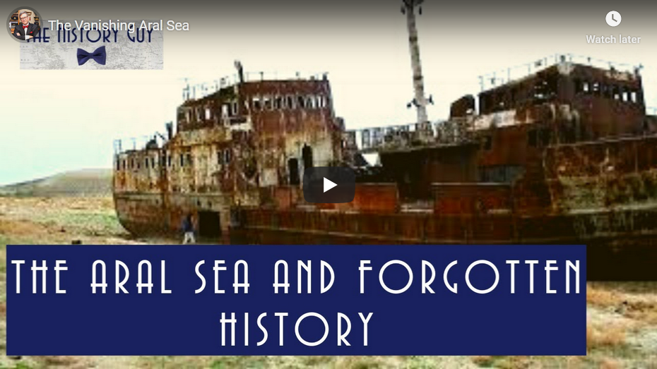
The Vanishing Aral Sea
The History Guy: History Deserves to Be Remembered
Published 22 May 2017The History Guy examines the Aral Sea and the confluence of geography and history.
The History Guy uses images that are in the Public Domain. As photographs of actual events are often not available, I will sometimes use photographs of similar events or objects for illustration.
Patreon: https://www.patreon.com/TheHistoryGuy
The History Guy: Five Minutes of History is the place to find short snippets of forgotten history from five to fifteen minutes long. If you like history too, this is the channel for you.
Awesome The History Guy merchandise is available at:
teespring.com/stores/the-history-guyThe episode is intended for educational purposes. All events are presented in historical context.
#history #thehistoryguy #worldhistory
Comments Off on The Vanishing Aral Sea
April 21, 2020
QotD: Admiral Jackie Fisher’s five keys to “lock up the world”
Moreover, a huge fraction of global trade flows through a few key choke points. A century ago, Jackie Fisher described “Five keys [that] lock up the world! Singapore. The Cape. Alexandria [Suez]. Gibraltar. Dover.” Today, we’d have to add the Strait of Hormuz, but the basic truth remains the same. Control of trade through these critical areas gives immense power, and it is in the interest of a maritime power to have that control, or at least to have great influence over how it is used.
“bean”, “Basics of Naval Strategy”, Naval Gazing, 2018-01-22.
Comments Off on QotD: Admiral Jackie Fisher’s five keys to “lock up the world”
April 20, 2020
QotD: The Columbus myth
My favorite example is the Columbus myth, the idea that the people who argued against Columbus were ignorant flat-earthers who thought his ships would sail off the edge. That is almost the precise opposite of the truth. By the time Columbus set off, a spherical Earth had been the accepted scientific view for well over a thousand years. Columbus’s contemporaries not only knew that the Earth was round, they knew how big around it was, that having been correctly calculated by Eratosthenes in the third century B.C.
By the fifteenth century they also had a reasonably accurate estimate of the width of Asia. Subtracting the one number from the other they could calculate the distance from where Columbus was starting to where Columbus claimed to be going and correctly conclude that it was much farther than his ships could go before running out of food and water. The scientific ignorance was on the side of Columbus and those who believed him; he was claiming a much smaller circumference for the Earth and a much larger width of Asia, hence a much shorter distance from Spain to the far end of Asia. We will probably never know whether he believed his own numbers or was deliberately misrepresenting the geographical facts in order to get funding for his trip in the hope that he would find land somewhere between Spain and Japan, as in fact he did.
David D. Friedman, “Slandering the Past”, Ideas, 2018-02-14.
Comments Off on QotD: The Columbus myth
January 18, 2020
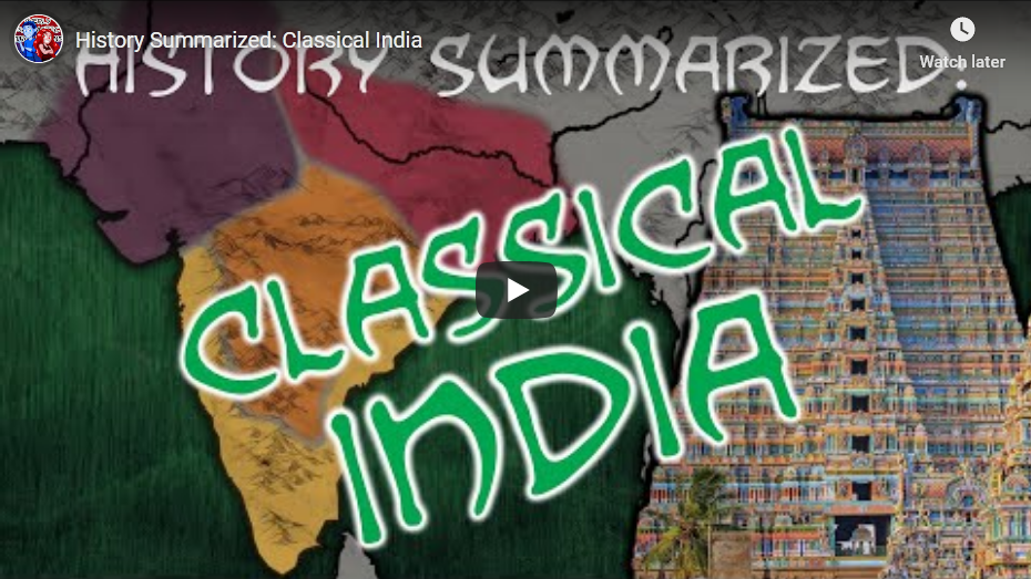
History Summarized: Classical India
Overly Sarcastic Productions
Published 17 Jan 2020Classical and Medieval Indian History is a tale of constant flux — but in between the dozens and hundreds of states at play across the peninsula, there are clear trends that arise. Let’s take this chapter of history as an opportunity to dig into different types of sources, and try and wrap our heads around a story that doesn’t fit neatly into a single chronology.
FURTHER SOURCES: The Discovery of India by Jawaharlal Nehru, “A History of India” by Michael H. Fisher (lecture courtesy of The Great Courses).
Our content is intended for teenage audiences and up.
PATREON: https://www.Patreon.com/OSP
DISCORD: https://discord.gg/y7uUnzJ
MERCH LINKS: https://www.redbubble.com/people/OSPY…
OUR WEBSITE: https://www.OverlySarcasticProductions.com
Find us on Twitter https://www.Twitter.com/OSPYouTube
Find us on Reddit https://www.Reddit.com/r/OSP/
Comments Off on History Summarized: Classical India
December 22, 2019
The North Magnetic Pole … a refugee from Canada’s Arctic
Colby Cosh on the latest refugee to flee from Canada:
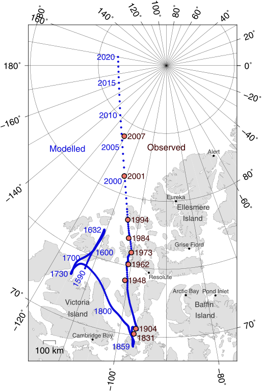
On Dec. 10, the World Magnetic Model used to calibrate compasses was officially updated. The “model” can be thought of as a map that you would use, given your location on or near the Earth’s surface, to find out how many degrees your magnetic compass is off from true geographic north (or south). This ordinarily happens every five years, but the wizards in charge of the system decided to update a year early because the north magnetic pole is moving particularly fast right now.
Positions of North Magnetic Pole of the Earth. Poles shown are dip poles, defined as positions where the direction of the magnetic field is vertical. Red circles mark magnetic north pole positions as determined by direct observation, blue circles mark positions modelled using the GUFM model (1590–1890) and the IGRF-12 model (1900–2020) in 1 year increments. For the years 1890–1900, a smooth interpolation between the two models was performed. The modelled locations after 2015 are projections.
Map by Cavit via Wikimedia Commons.As most Canadians will have heard, magnetic north is, at the moment, fleeing Canadian territory and heading toward Russia. The rate of change is still very high by historic standards, first established in the early 19th century, but it has slowed just a little. In the year 1900 the pole was firmly in the Canadian Arctic, off Somerset Island. It wandered north, broke out of our high Arctic archipelago in about 2000, and has been streaking Siberia-ward across the open sea at more than 50 km a year since. The time component in the new WMM forecasts a slight slowing over the next five-year period, to about 40 km/yr.
This, like everything else involving Earth’s magnetic field, is a bit of a guess. The WMM has to be updated often because it does incorporate guesswork about the magnitude and direction of changes in the short-term future. The model will be most accurate now, and increasingly less so over the five-year term as the magnetic poles do their little dance — independently, by the way; the magnetic poles are not exactly opposite the Earth from one another, and the “south” one is scooting along much more slowly than the “north.” (Also, the magnetic north pole, the one to which the “north” needle of your compass is attracted, is actually a “south” pole to physicists.)
The truth is that the naive inquirer should not research Earth’s magnetism in the expectation that it is as well understood by scientists as, say, oceanic tides. (You can probably detect that I am talking about myself here.) The question “Why is the magnetic pole leaving Canada?” does not really admit of a solid answer. Maybe it’s the investment climate?
Probably most everybody is dimly aware that the magnetic poles flip outright from time to time — every half-million years on average. But the assumptions embedded in your handheld compass run much deeper than that. The Earth itself is only a big dipole magnet generally, rather than locally, and there is no guarantee of only one “north magnetic pole” as the field is measured near the surface. Competing “north poles” can form. (Which would, at least, let Russia and Canada each have their own …)
Comments Off on The North Magnetic Pole … a refugee from Canada’s Arctic